Why Three Places Keep Calling Me Back
The Spessart does not offer sensational highlights that thrill or overwhelm you.
One might even say it offers something better: balm for the soul.
It is home to the largest continuous area of mixed deciduous forest in Germany. Within this landscape, the Spessart water landscapes of a quiet and often overlooked world of lakes, streams, and wet meadows.
And yes, you can walk for hours through these forests without encountering another soul.
Only the whisper of leaves, birdsong, the tapping of a woodpecker, and the rustle of an unseen animal in the undergrowth.
If you are lucky, you might spot wild boar, foxes, beavers, or deer – or simply drift away, lost in your own thoughts and inner worlds.
The Spessart also holds very special places that reveal themselves only to those who have a trained eye and the sensitivity to truly perceive them.
These places do not open themselves at just any time.
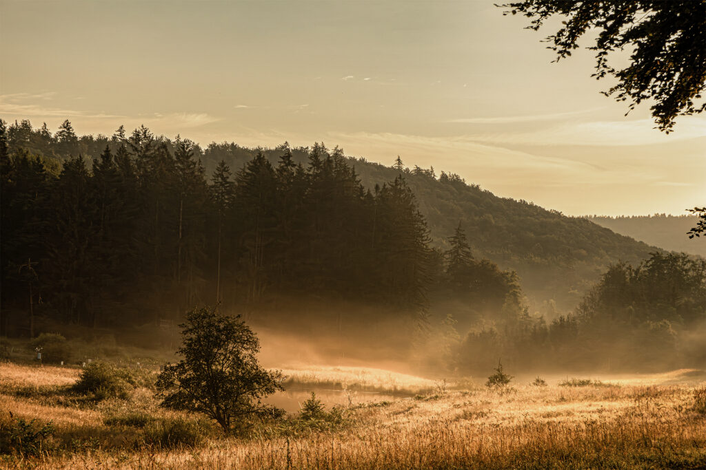
Most often, it is in the early morning hours, when mist softens and filters the rays of the rising sun.
In these moments, you are gently drawn in and carried into an enchanted, almost fairytale-like world.
Such moments must be kept in the heart, because they never return.
They may come again in a different form – perhaps even more beautiful – but never as the same image.
There are three such places I carry within me.
And wherever I may be in Europe, no matter how wild or fascinating the landscape, I always realize that places like Breitsee, Weihersgrund, and the Spessart meadows can only exist here – and nowhere else but in the Spessart.
Breitsee – A Hidden Lake in the Spessart
The Hidden Path to the Breitsee
A small, hidden lake – like an enchanted place
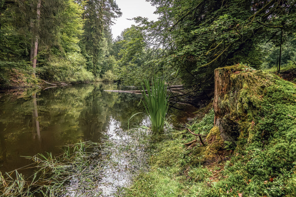
The Breitsee is, for me, a place of quiet return. I have come here many times because it radiates a special, almost mystical calm – secluded, timeless, far removed from everyday life.
It lies on the southwestern edge of Rothenbuch, near the sports and recreation area Am Setzborn. From here, a narrow path runs parallel to the ST2317 road, which is barely noticeable: the path lies lower, dense woodland separates it from the road, and after just a few steps you feel embraced by the Spessart forest.
Along the way, you pass the Gemeindemühle, which is difficult to spot from this side – especially in spring, when everything is in full bloom. After about 400 metres, the path crosses the Hafenlohr stream and meets a wider forest track. Following it to the right, you first walk alongside the Hafenlohr and, almost without noticing, later along the Steinbach – until the forest opens and the Breitsee appears.
A Quiet Place Out of Time
At that moment, the world seems to slow down. The water lies still, reflections merge into one another, and the place feels out of time – as if the forest had deliberately hidden it away.
Those who do not let themselves be completely lulled by the Spessart forest will notice a small clearing with a bench. From here, there is a beautiful view over the Hafenlohr valley, where the stream bends sharply to the left. From this vantage point, the Breitbach can also be seen as it joins the Hafenlohr – quietly, almost unnoticed, yet marking the beginning of an entire landscape.
Parking and Ways to Experience the Breitsee
Parking (recommended starting point near “Am Setzborn”)
📍 49° 57.816′ N, 9° 23.391′ E
Near the sports and recreation area Am Setzborn in Rothenbuch, there is a signposted public car park.
Directly opposite this official parking area, on the other side of the road, is an unofficial but recommended parking spot.
Although not signposted as a car park, this alternative location is the better choice: it places you directly at the beginning of the narrow forest path, allowing you to start the walk immediately without crossing the sports and recreation grounds.
Breitsee (lake location)
📍 49° 57.092′ N, 9° 22.549′ E
A small, protected forest lake and the source of the Breitbach, hidden within dense woodland.
Viewpoint over the Hafenlohr Valley
📍 49° 56.940′ N, 9° 23.417′ E
A quiet clearing with a bench, offering a beautiful view into the Hafenlohr valley and towards the confluence area of the Breitbach.
Background Information about the Breitsee
The Breitsee marks the source of the Breitbach, a right-hand tributary of the Hafenlohr with a length of around 1.3 kilometres, located in the district of Aschaffenburg in the Bavarian Spessart. The spring lies southwest of Rothenbuch at the foot of the Eselshöhe ridge.
Covering an area of only about 0.3 hectares, the Breitsee was created in the 1930s for timber rafting and is now designated as a protected natural monument. It is assumed that a similar body of water existed at this location even earlier. Despite its modest size, the Breitsee forms the quiet beginning of a small but characteristic fluvial system within the Spessart.
Weihersgrund – Where a Meadow Turns into a Hidden World
The Right Time and the Right Place
Where an Ugly Duckling Turns into a Swan
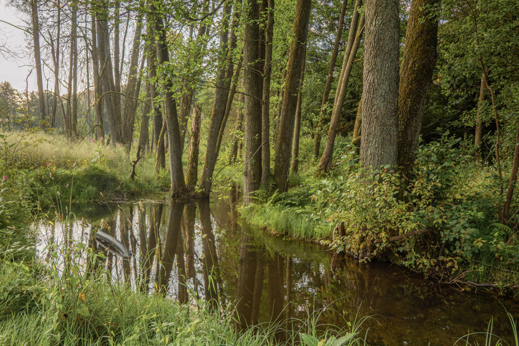
The Weihersgrund can be disappointing at first glance.
At the wrong time, it is little more than a simple meadow, crossed by the narrow and unassuming Metzenbach stream.
This is precisely why timing and position are everything here.
The time is easy to define: the early morning hours.
The place, however, can only be suggested.
This experience cannot be handed over or guaranteed – it has to be discovered and claimed by each visitor individually.
Parking and Ways to Experience the Weihersgrund
The best place to park is near the coordinates N49° 53.909′ E9° 26.396′, where a forest track branches off from road St2312.
There is usually space for a small car.
Alternatively, you can use the official parking area located about 500 metres further along, coming from the motorway.
In this case, however, you will need to walk back along the road to reach the starting point.
From the forest track, follow the path for approximately 600 metres.
A narrow trail then branches off and, after another 400 metres, leads to the Metzenbrunnen (N49° 54.191′ E9° 26.368′), the source of the Metzenbach.
From here, the next two kilometres form what is, in my opinion, the most beautiful section of the Weihersgrund.
Those who wish can continue on to the Sylvan Forest Lodge (N49° 54.141′ E9° 28.777′), an excursion restaurant accessible only on foot or by bicycle.
This adds another 1.5 kilometres one way, which of course also have to be walked back.
Background Information about the Weihersgrund
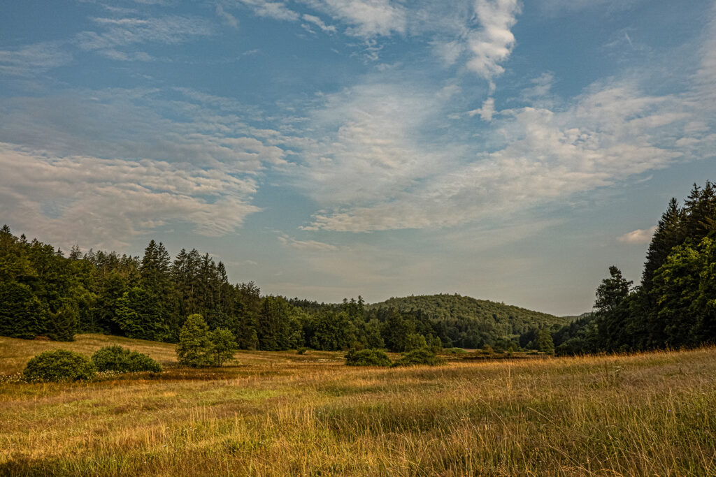
The Weihersgrund is a designated nature reserve of about 43 hectares in the Bavarian Spessart, located about 4 km north of Bischbrunn along the upper course of the Heinrichsbach, a minor tributary of the Hafenlohr that eventually flows into the Main.
This gently wooded valley lies at approximately 370 m above sea level, while surrounding heights, including the Geiersberg—the highest peak in the Spessart—reach about 586 m.
The area features wet and moist meadows, spring zones and peat formations supporting a rich diversity of plant life such as round-leaved sundew, cranberry, arnica, and globeflower, while beavers are known to shape sections of the Metzenbach and surrounding waters.
A particular charm of the Weihersgrund lies in its remoteness and silence, where the small streams Metzenbach and Weihersbach merge within the reserve to form the Heinrichsbach, giving the landscape its gentle rhythm and a quiet sense of wilderness.
Spessart Meadows – Where Water and Grass Create Living Landscapes
Wet meadows along the Lohr and Aubach streams
A landscape shaped by water, light, and quiet persistence
Fließtext
The Spessart meadows are a series of wet and marshy grasslands stretching along the Lohr and Aubach streams, as well as sections of the Lohr river itself.
I explored these meadows near Heigenbrücken, Neuhütten, and Wiesthal, and was fascinated by the quiet creativity of nature unfolding there.
Compared to the more subtle places, the Spessart meadows are generous even to less sensitive visitors.
Their special character reveals itself almost immediately — you only need to open your eyes a little.
They are also less dependent on a specific time of day, although the early morning hours are simply unbeatable.
These are not just meadows.
With a bit of imagination, they can even evoke memories of the Everglades in Florida — without the alligators, of course.
The Spessart meadows can be explored from several access points. Below are the most rewarding routes near Heigenbrücken, Neuhütten, and Wiesthal.
Parking and Ways to Experience the Spessart Meadows near Heigenbrücken
The Spessart meadows near Heigenbrücken are best explored when coming from the village and following the AB23.
At coordinates N50° 01.849′ E9° 20.778′, turn right onto a small forest track and follow it parallel to the AB23 until you reach a wooden footbridge (N50° 02.016′ E9° 20.686′).
You can park along the roadside here; the spot is easily accessible with a small car.
After crossing the footbridge, follow a beautiful forest path toward Heigenbrücken, always alongside the Lohr stream, until you reach the natural swimming area.
Behind it, cross the Lohr once more and return along the opposite bank.
Near the water-treading basin, you are rewarded with a completely different and particularly striking view of the meadows.
The first 400 metres of the path can be challenging after heavy rainfall, as it becomes overgrown and very wet — but the effort is well worth it.
If you prefer not to park near the wooden bridge, there is an official parking area along ST2317, above the natural swimming area.
From there, cross the Lohr first and turn left onto the forest path — or take the more adventurous option and follow the damp, densely overgrown trail that runs parallel to ST2317 before reaching the swimming area.
Parking and Ways to Experience the Spessart Meadows near Neuhütten
To explore the Spessart meadows near Neuhütten, turn left before the railway station when coming from Heigenbrücken.
Signs for the climbing park or sports facilities may guide you, but following the coordinates is the safest option.
You can park along the roadside at N50° 01.288′ E9° 23.377′ or at the parking area near the wild boar enclosure (N50° 01.446′ E9° 23.418′).
From there, walk back toward the Anglersee and continue along a long stretch of path running parallel to the Lohr stream.
For much of this section, the stream flows to the right of the path but remains hidden from view.
After about one kilometre, you can cross the Lohr and return on the opposite side, where the stream runs much closer to the path and becomes visible.
I recommend continuing for another kilometre before crossing, as this latter section of the meadows is, in my opinion, the more rewarding one.
Parking and Ways to Experience the Spessart Meadows near Wiesthal
To explore the Spessart meadows near Wiesthal, you can park near the bus stop “Bahnhof Wiesthal” (N50° 01.084′ E9° 26.362′) or directly at the railway station parking area (N50° 01.026′ E9° 26.439′).
From the bus stop, with ST2317 behind you, you have a beautiful view over the marshy landscape.
Looking in the opposite direction, across ST2317, the scenery changes completely, opening up into wide meadowland.
While the marshland itself can only be viewed from a distance, a cycle and walking path runs across the open meadows toward Wiesthal.
After about 800 metres, turn right shortly before the village and return along the opposite side.
The return route is slightly longer, as it makes a small detour via a water-treading basin, adding another quiet and unexpected perspective to the walk.
Background Information about the Spessart Meadows
The Spessart meadows (Spessartwiesen) are a network of wet and marshy grasslands located along the Lohr, Aubach, and several smaller tributaries in the central Spessart region of northern Bavaria.
They form part of a traditional cultural landscape shaped over centuries by extensive meadow management and natural water dynamics.
These meadows are characterized by high groundwater levels, seasonal flooding, and nutrient-poor soils, creating ideal conditions for species-rich plant communities typical of wet meadows and fen landscapes.
Reeds, sedges, moisture-loving grasses, and flowering meadow plants form a mosaic that changes constantly with light, water level, and season.
Ecologically, the Spessart meadows play an important role as retention areas, helping to regulate water flow within the Lohr river system.
They also provide valuable habitats for insects, amphibians, and meadow-breeding birds, contributing significantly to local biodiversity.
Today, many sections of the Spessart meadows are under landscape or nature protection, preserving both their ecological value and their quiet, open character.
Despite their modest appearance, they represent one of the most distinctive wetland landscapes within the Spessart — subtle, expansive, and shaped by water rather than elevation